Drones are incredibly important for a range of applications. Some of the most exciting applications for drones is use them for deploying medicine, food, supplies, equipment to remote locations.
Hover, lift and deliver
Most larger drones or quads like the DJI inspire will lift anything from 2-4 pounds in weight and don't have means of attaching or releasing loads. This is where Hoverloads - The payload system comes in. It is an advanced tubular aluminium design simply bolts under the drone/quad. The servo mechanism is then attached to the sub-frame to allow the load to be released easily remotely.
Sketch
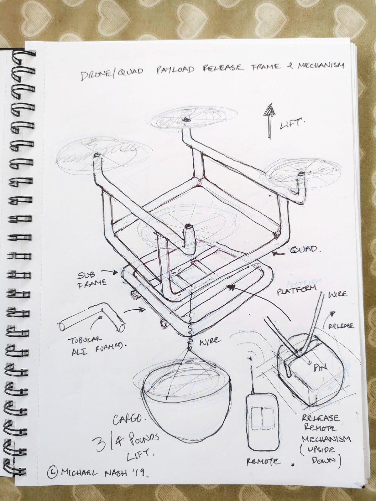 |
| Sketch of Hoverload |
Simply attach the load cable to the servo catch. Gently lift the load and fly to your destination. Once flown into position, release the load by pressing the remote button. The signal is transmitted wirelessly either 2.4gHz or 5.8gHz. The servo releases a stainless pin, the cable releases and the load is delivered. The system is designed to be very easy to use and re-use.
There are potentially so many uses for this technology. It could be simple as putting out small fires, delivering medicine to feeding fish remotely. The applications are many.
Please share and comment below.
Copyright - Mike Nash 2019
Comments
Post a Comment